Home > Street and River Photography > The Thoroughfare – South-Eastern side
The Thoroughfare - South-Eastern Side
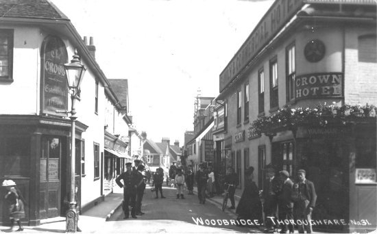
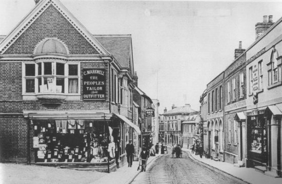
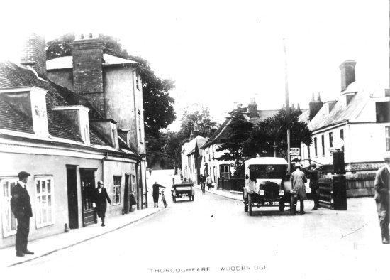
The man in the centre of this photograph is Horace Reynolds (c.1872-1910), the self-appointed traffic controller, who was known as Poll.
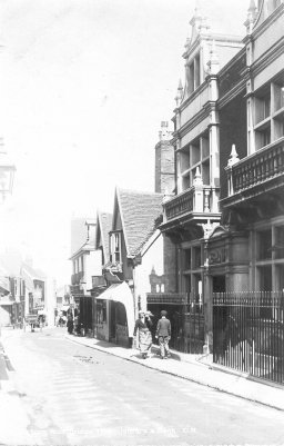
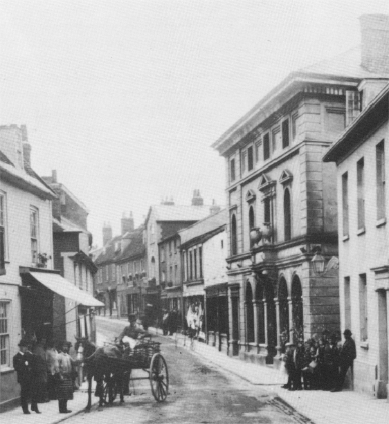
The building at 8 Thoroughfare, occupied by Lloyds Bank until 2025, was designed by T W Cotman in 1895 for Bacon, Cobbold, Tollemache & Co. Two-and-a-half storeys high, it towers above its neighbours. It is a mixture of red brick and limestone.
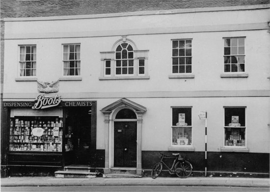
Some time after 1937 Boots took over the business and advertised themselves as Dispensing Chemists.
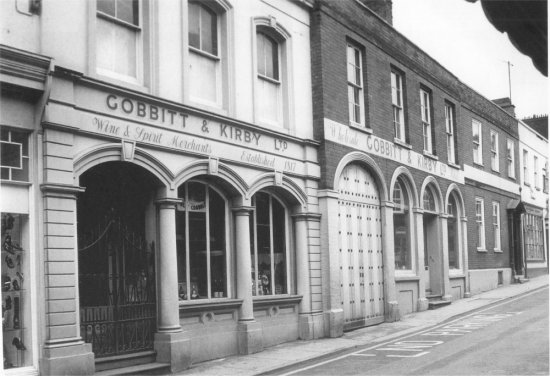
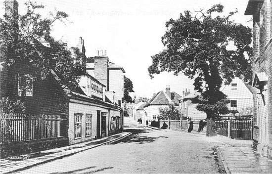
The arched door in the centre of this photograph is the entrance to the yard of Gobbitt & Kirby Ltd, circa 1974, when trading had ceased.
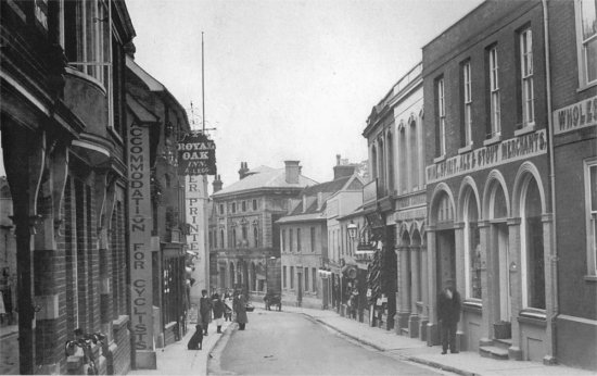
The premises of grocer and wine & spirit merchant F. W. Gobbitt, who went into partnership with his brother-in-law R. W. Kirby in 1915, are seen here circa 1905, with the name of their predecessors James Gross & Co. still on the shopfront.
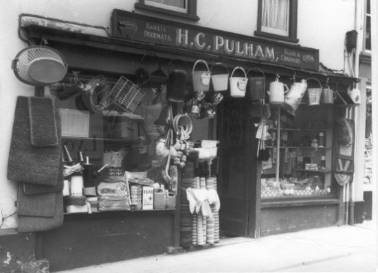
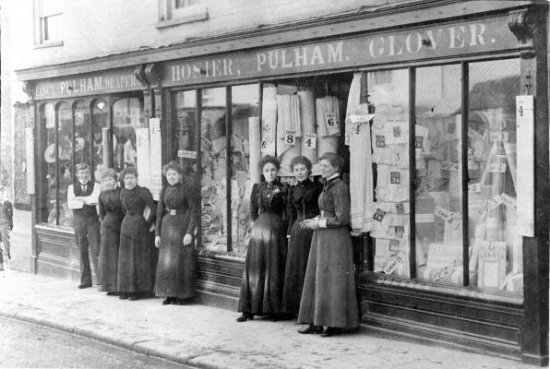
Pulham – fancy draper, hosier and glover – was in the building which is now Peacocks.
Photographed circa 1919, the Bon Marché at 32-34 Thoroughfare was owned by William Savage.
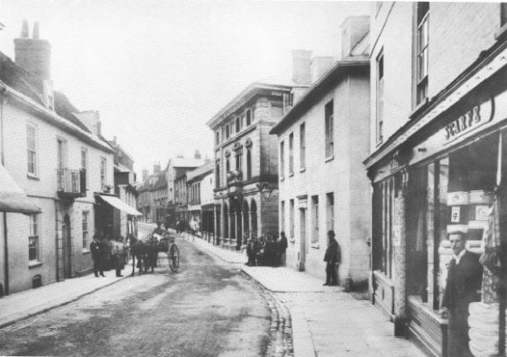
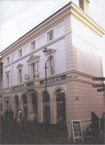
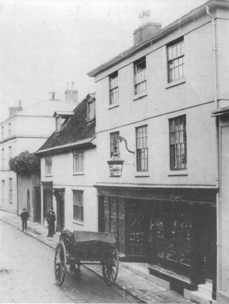
No 40 is the three-storeys-high building in the centre of this photograph. It is a fine Victorian shopper’s paradise which was designed in 1846 but has an earlier core.
The photograph was taken circa 1900.
The full grandeur of the building is best seen in this modern photograph. Barretts’ home furnishings store was here for 57 years from 1969 to 2026.
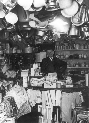
Walker’s grocery store was on the left side of the building. This photograph shows the interior of the store.
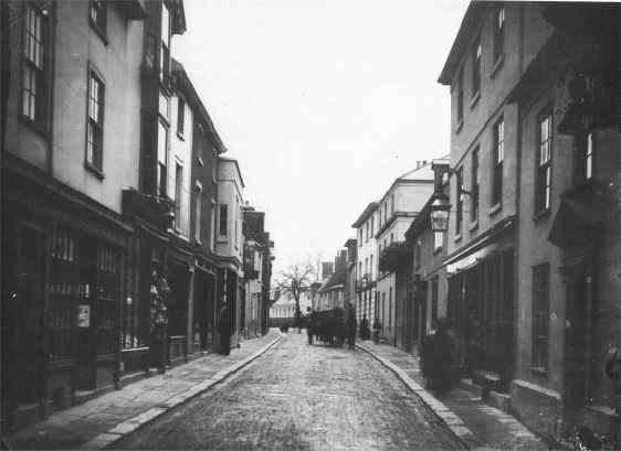
This circa 1900 photograph shows that beyond the imposing Victorian shopper’s paradise (no. 40) there was a succession of small shops. There was then a three-storey residential property which would eventually be incorporated into the imposing entrance on the Thoroughfare which lead to the Turban Centre.
Sadly, there are no detailed images of the shops in the centre of this photograph.
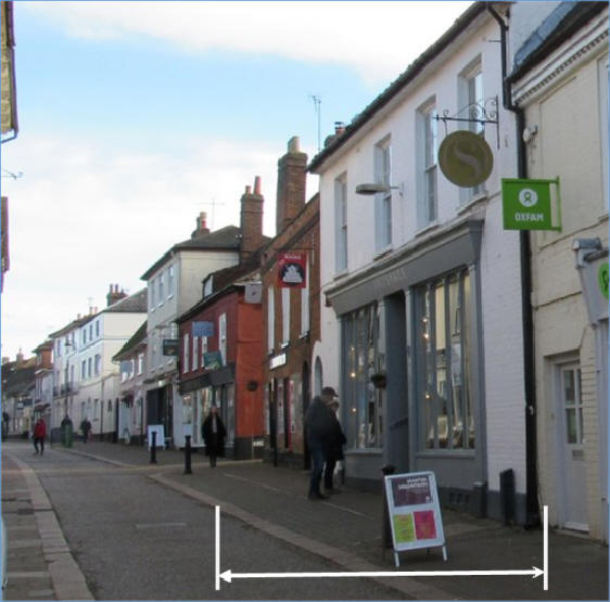
There is a short gap in the photographic record of the circa 1900 buildings on the Thoroughfare. The gap is between the imposing entrance on the Thoroughfare to the Turban Centre and the passageway leading to Elmhurst park. The extent of this gap is shown by the white arrow on the 2021 photograph on the right.
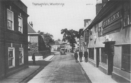
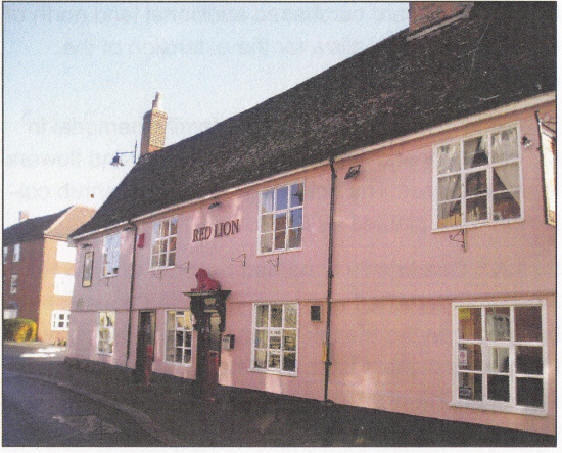
This circa 1900 photograph, and the one below it, indicate that there were a total of four shops and the Lion Public House before reaching Lime Kiln Quay Road.
This circa 1900 photograph clearly shows a substantial brick-built building which abuts the Lion Public House and the building can also been seen on the photograph below.
The brick-built building at the entrance to Lime Kiln Quay Road remained in place until the Thoroughfare bypass was completed in 1976 and the entrance to Lime Kiln Quay Road had to be widened.
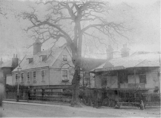
This is the earliest image showing the buildings around the junction of Lime Kiln Quay Road and the Thoroughfare.
The iron foundry was built during the 1840s. It started as Bendall’s Agricultural Implements and Engineering Works which initially produced foot ploughs; other agricultural implements and machines; carts; and iron and wire fencing. In 1886 the foundry was bought by Mr L A Scott who started to produce a range of gas fittings and gas scrubbers. In 1889 he patented a “gas or oil burning hot water warming portable stove. The invention is a thoroughly practical and valuable one, the stove conveying warmth where circulating pipes and boilers would prove too costly. Ventilation and purity of atmosphere is ensured, thereby recommending itself to householders and others for economy, safety, utility, and health.” In 1891 Scott departed to carry out extensive works in the island of Puerto Rico. The business and its 32 employees were left in the hands of his sons. Alfred Barnes bought the foundry in 1894 and ran it in partnership with timber merchant Philip Brown until 1902 or soon afterwards.
In 1909 the former foundry site was taken over by Adams Cycle and Motor Works – the makers of the St John pedal cycles and the first business to cater for motorists in Woodbridge. (Mr A Adams had previously operated from a shop on the Thoroughfare.)
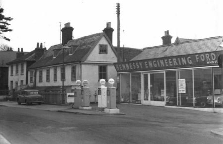
From 1925 Potter & Bensley motor engineers occupied the former foundry site. It was subsequently used by agents for agricultural equipment and then as a petrol station, car show room and workshop.
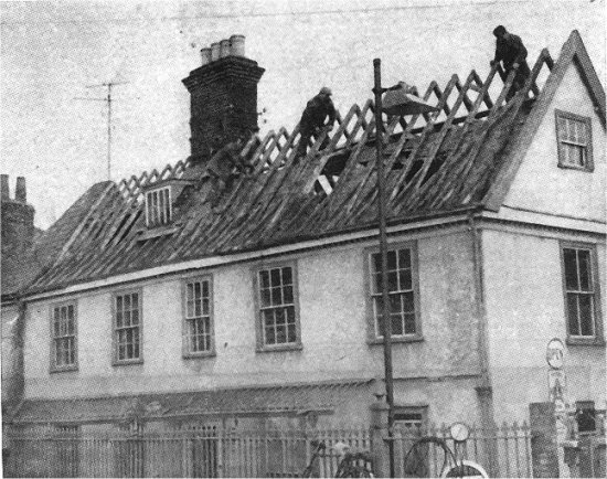
The next stage was to demolish the timber-framed house to the left of the show room in order to expand the latter.
This once elegant timber-framed building was demolished in the early 1970s.
Hennessy Engineering took over A H Potter’s enterprise in 1964 and eventually expanded the showroom by demolishing an elegant house on the Thoroughfare. When the Thoroughfare bypass was completed in 1976 the entrance to Lime Kiln Quay Road had to be widened. To do so the two-storey brick building which used to abut the Red Lion public house had to be demolished.
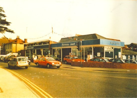
The most recent change to the Lime Kiln Quay Road area occurred in 1989 when the petrol station, car showroom and garage on the corner of the Thoroughfare and Lime Kiln Quay roads were demolished. The site was then used for Suffolk Place, a complex of retirement flats, houses, garages and parking spaces.
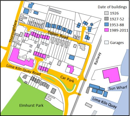
All the changes which have occurred since the Thoroughfare bypass was built are summarized in the map on the right. It show’s the area around Lime Kiln Quay Road area in 2011. The colour coding of the buildings indicates when they were built.
During the Second World War, the National Fire Service moved the fire station from Cumberland Street to the what was then open space on the northern side of Deben Road. The building was only of temporary construction and, in 1961, the brigade moved to the new location in Theatre Street. Soon after houses were built on the vacated site.
From 1989 an adjoining plot of land on Deben Road was used for 11 new houses. The final change occurred in 2011 when a second house was built on the large plot abutting the car park.
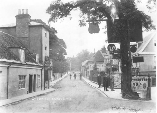
For many years Deben Road had provided access to Sun Wharf from the Thoroughfare but in 1976 bollards had been erected at the end of Deben Road to block access by vehicles.