Home > The Story of Woodbridge > Landscape
The Landscape
Landscape plays a key role in determining how settlements evolve. The foundation of the landscape of Woodbridge was formed during those periods when that part of the earth’s crust which is now East Anglia was under the sea. During these periods of immersion, layers of sedimentary deposits were laid down.
The Geological Strata Underpinning the Landscape
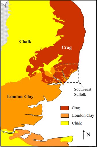
This map shows how the top layer of the sedimentary deposits varies across East Anglia and around the Thames estuary.
The chalk was formed during a period which started 144 million years ago and ended 70 million years ago. The layer extends from the north-west corner to well beyond the coast.
Between 60 and 49 million years ago most of the southern area was beneath a broad estuary into which flowed the early Thames and other rivers. The silt they carried formed a layer of clay, called London clay, on top of the chalk.
From 4 to 1.8 million years ago the north eastern part of the region was beneath a shallow sea which deposited a layer of shelly sand called crag.
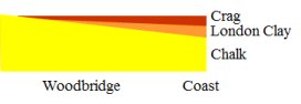
A gradual tilting of the earth’s crust has resulted in the layers of crag, London clay and chalk, in south east Suffolk being stacked as shown below. Under Woodbridge the crag is about 13m thick, the London clay about 15m and the chalk 400m.
Map showing how the top layer of sedimentary deposits varies across East Anglia and around the Thames estuary.
A simplified cross-section through the sedimentary deposits between Woodbridge and the coast.
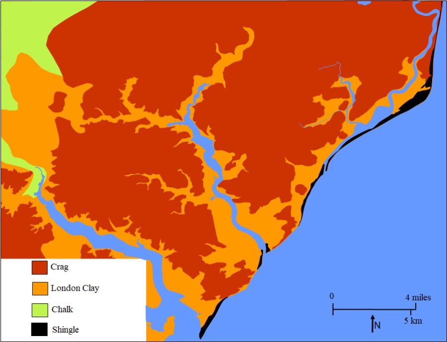
Map showing the extent to which rivers and streams have cut into the sedimentary deposits
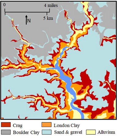
The map on the right shows the surface layer of the sedimentary deposits around the upper part of the Deben estuary.
Having described the wider area it is now possible to restrict the rest of the discussion to south east Suffolk.
The Types of Soil
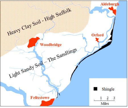
The Heavy Clay Soils which covered High Suffolk were formed from material deposited by an ice sheet which moved slowly down from the north about 400,000 years ago and reached the edge of what is now Woodbridge. It covered the area shaded orange on this map.
When the ice sheet melted it left a layer, up to 30 m thick, of clay and boulders on the ground it covered – the area now called High Suffolk. Sands and gravel were carried away by the melt waters and were spread over the coastal region – the area now called The Sandlings.
Woodbridge is on the boundary between two distinct soil types. The surrounding area is thus the source of a diverse range of agricultural produce. The town prospered as a market centre because the navigable estuary enabled produce to be shipped to London area. For a while the town also prospered because ships were built here using fine oaks from High Suffolk.
The variation in the type of soil across south-east Suffolk.
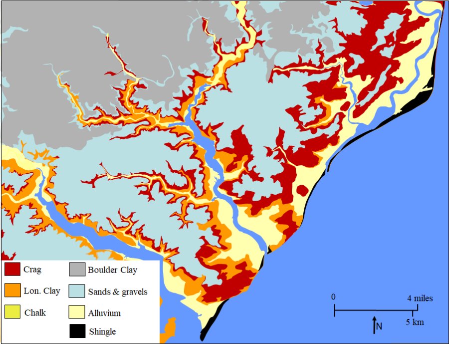
Maps showing the extent to which rivers and streams have cut into the material deposited by the ice sheet
The map on the right shows how the rivers and streams have cut into the Boulder Clay and the upper layer of Crag. Below the Crag rivers and streams have cut into the under-layers of London Clay and Alluvium.
The geological data on which the map is based also shows the extent to which alluvium carried by the rivers and streams has built up along their banks. In some cases the alluvium has led to the formation of extensive areas of salt marsh many of which have been reclaimed by building river walls.
A similar map for the whole of South East Suffolk is given below.
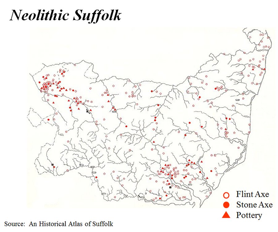
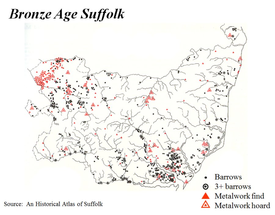
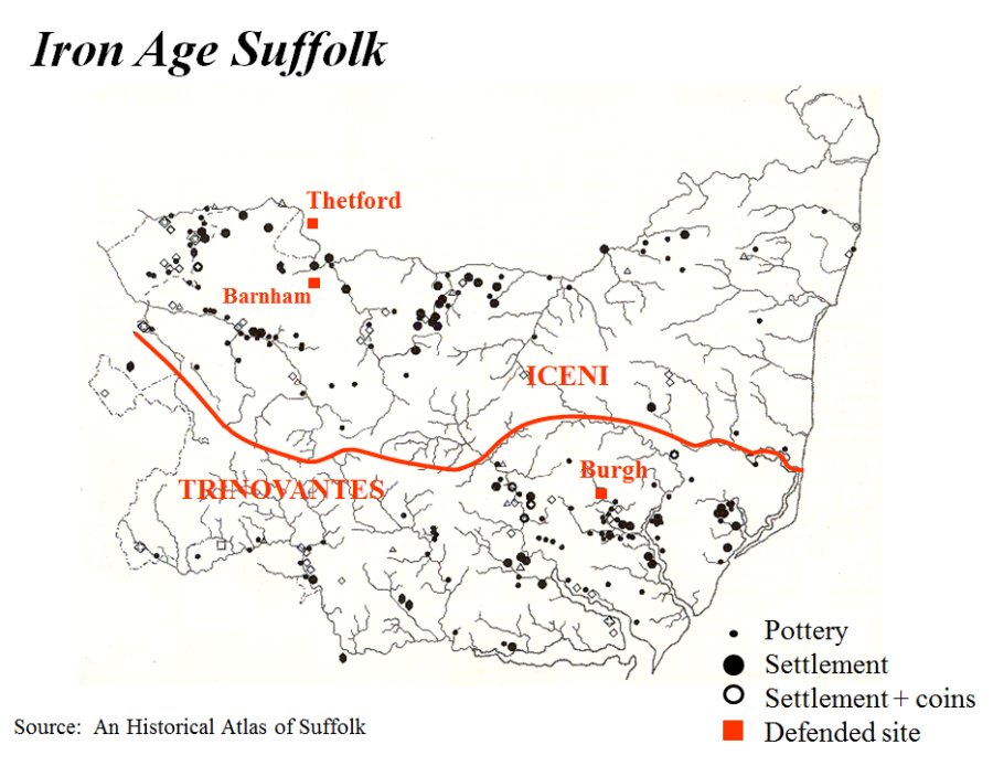
Most of the settlements of our Stone Age, Bronze Age and Iron Age ancestors were in the areas of light sandy soil along the coast. Although these were areas of poor fertility the intensity of farming was low enough for it not to be a problem. Some of the key features of the coastal area were, however, significantly different from those today.
Locations in Suffolk which have yielded archaeological evidence of early settlement
The Shape of the Early Estuaries
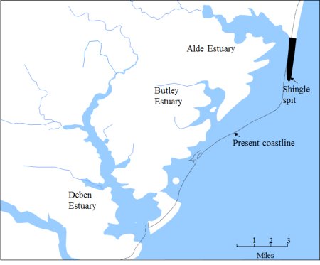
About two thousand years ago, as this map shows, the estuaries of the rivers Deben, Butley and Alde were much wider than today. They had started to form about 3,000 years earlier as the sea level rose and flooded the river valleys.
Two processes transformed these wide estuaries. Firstly, erosion and deposition caused by the tidal flow of the North Sea has caused parts of the coast line to recede by half a mile and the shingle spit, now known as Orford Ness, has become much longer.
Secondly, alluvium carried by the rivers resulted in the growth of extensive salt water marshes (salt marshes) along the edges of the estuaries.
The Estuaries Today
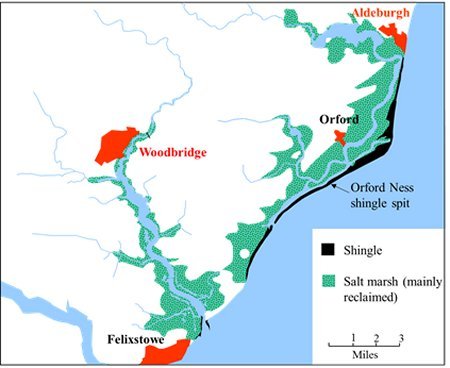
This map shows the extent of the salt marshes which have built up. Most of these marshes have been reclaimed by building river walls. The marshes in the upper reaches of the Deben estuary were reclaimed in the early 1600s.
The river walls confined the river and thereby eventually deepened it. Larger ships were thus able to reach Woodbridge and this increased the maritime trade.
In some cases the river walls has not been maintained and recovered land has reverted to salt mash.
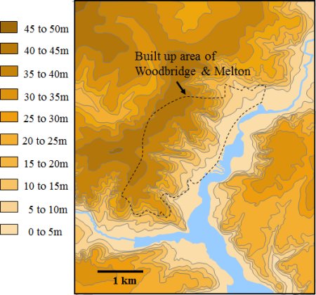
The Side Valleys which Shape Woodbridge
This map shows the extent of the salt marshes which have built up. Most of these marshes have been reclaimed by building river walls. The marshes in the upper reaches of the Deben estuary were reclaimed in the early 1600s.
The river walls confined the river and thereby eventually deepened it. Larger ships were thus able to reach Woodbridge and this increased the maritime trade.
In some cases the river walls has not been maintained and recovered land has reverted to salt mash.