Castle Street and Victoria Road

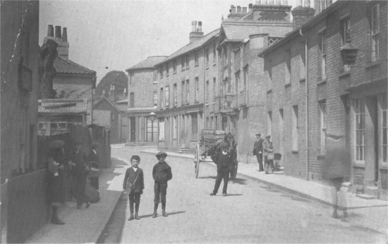
This circa 1900 photograph shows the view looking up New Street from The Thoroughfare. The entrance to Castle Street and St Johns Hill is to the left of the three storey building with a semicircular frontage.

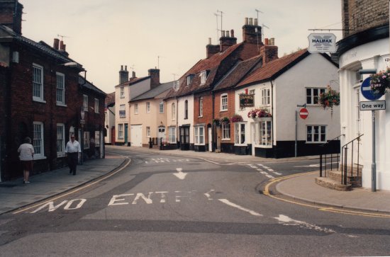
This 2010 photograph shows the entrance to Castle Street and St Johns Hill in greater detail. It is between Frames by Robert and and a branch of the Halifax Building Society (now Gymaphobics).

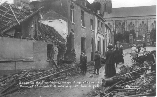
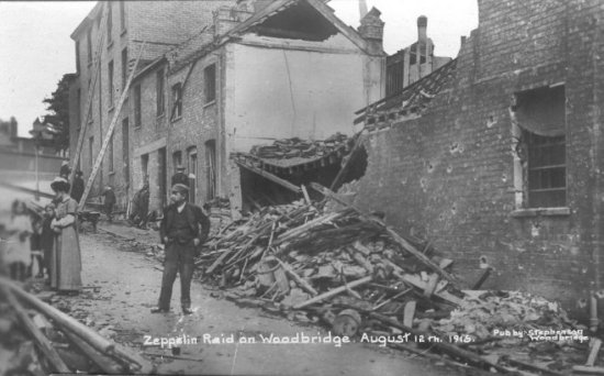
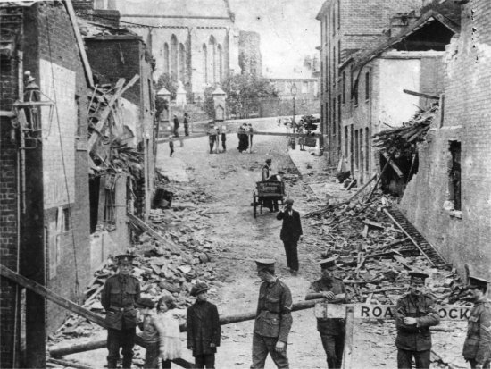
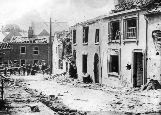
The first of the high explosive bombs, dropped by the Naval Zeppelin L10 on the 15th August 1915, caused extensive destruction to the entrance of Castle Street and St Johns Hill. The Castle can just be seen at the top of this photograph.

In 1560 the road was called Myll Way because it was the way to the Lords water mill. By the eighteenth century there were four windmills along the ridge above the road.

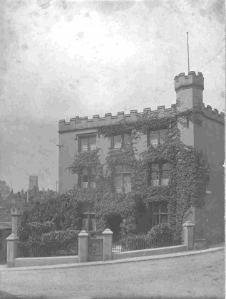
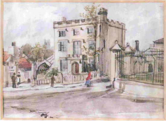
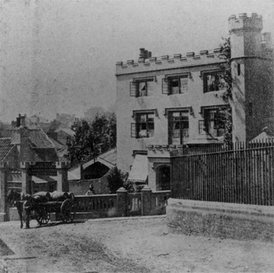
The house shown on the right had features which made it look like a castle. For this reason Myll Way became Castle Street.

Imposing mansion on the right was built in 1812 by William Lockwood to promote a new cement that his building firm was an agent for. His cement was waterproof and was thus suitable for cladding the outside of buildings. It could also be painted by a stone colouring which make it appear like stone.

The mansion had walls and a flat roof that were completely clad in concrete and there were concrete mouldings around the windows. The addition of battlements and a tower in one corner resulted in the Mansion henceforth being known as ‘The Castle’.

The cement roof proved to be a step to far. Although the cement was a barrier to water, it cracked due to the movement of the underlying roof timbers, and eventually slate had to be used.

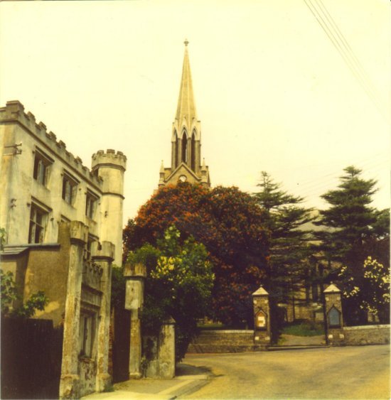
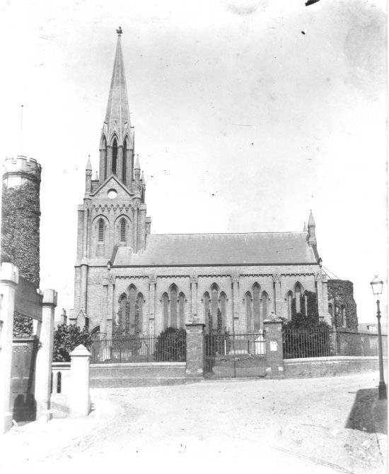
This photograph shows The Castle and the gateway to St Johns Church.

Thomas Churchyards painting of ‘The Castle’ in 1890.

William Lockwood’s eldest son did not join the family firm. In 1829 he set up business with a disused brewing plant that was in the grounds of The Castle. Within two years the business expanded so much that The Castle became part of the establishment. The main outlets were the Mariners Arms adjacent to the Brewery and another in on the Market Hill.

In 1888 the brewery was sold to a local maltster and it remained a thriving concern until the 1930’s. From 1933 to 1937 Lockwood and Co. traded as Wine and Spirit Merchants, Ale, Cider and Stout bottlers, but were not classified as Brewers.

In 1948 The Castle was sold to A H Potter & Co. It was subsequently known as St John’s Works and was used as store room with flats above. It may also have been use d by a fishmonger. On January 14th 1963, it was served with a Compulsory Notice for Demolition as part of a redevelopment of Castle Street. It had stood for approximately 155 years, a unique building.

The Little Castle is still a private residence.

St John’s Church was built as a result of the energy of the Reverend Henry Hardinge. He became rector at St Mary’s in 1839 and his preaching filled the church to overflowing. He then started the project of building a new church or ‘chapel of ease’ on part of some former grazing land at the bottom of Castle Street. This land, which had been put up for sale in 1840, had previously been rented to a herdsman named Pite for grazing. Within two years £2,600 had been raised to build the church. The foundation stone was laid in June 1842 and the church was eventually consecrated in 1846.

The church originally had a tower topped with an elegant spire rising to the height of 138 feet but the spire had to be removed, in the 1970s, because iron bars used to reinforce the stonework had corroded. The remaining stumpy tower never looked right and but this was rectified when an anonymous benefactor came forward to fund a new spire which was erected in 2003.

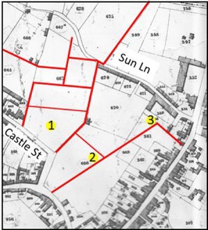
During the 1840s there were further developments further up Castle Street. A number of new streets were laid out and they are shown here as a red overlay on the tithe map. However, the demand for houses along these streets was not as great as expected and the development was not completed until the end of the century.

Three major public buildings were built in the area. They were the St John’s Church (marked 1) Woodbridge Literary and Mechanics Institute (marked 2) and the Wesleyan Chapel (marked 3).

William Martin, a writer of children’s books under the pseudonym Peter Parley, spent most of his life at Woodbridge and was a friend of the Lockwoods. He suggested to William Jnr. that they should form a literary and scientific society. This lead to the foundation the Woodbridge Literary and Mechanical Institute in 1838 and William Jnr. was it first secretary.

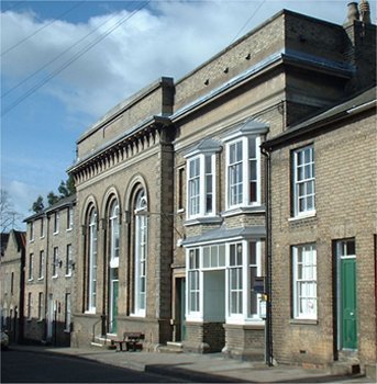
Literary and Mechanics Institutes had sprung up all over the country to satisfy a thirst for education by both young and old. The Woodbridge Institute had started in 1835 and by 1852 a group of shareholders put up £300 to provide the Institute with a building in St John’s Street. A further £1000, raised from £5 shares, was used to build an adjoining Lecture Hall. The latter was a large handsome building of white brick. It was let for various purposes and could accommodate 500 persons. At its zenith the Institute had about 100 members and a library of about 5000 volumes. The Lecture Hall was eventually taken over by the YMCA and in 1929 it was converted to the Roman Catholic Church of St Thomas of Canterbury.

In 1812 a soldier drummer of the Lincolnshire Regiment, who was also a Methodist local preacher, was granted permission to hold services in the Woodbridge barracks. Later, services were held in two hired rooms in the town. Then, in 1829, a chapel was built in Brook Street. It is now a private residence (No. 20) having been replaced, in 1872, by the chapel on St John’s Street.

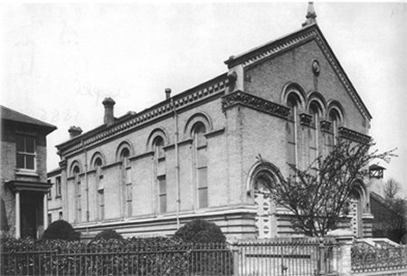
When the new Methodist Chapel was opened it could seat 350. The interior of the church was subdivided, in 1963, to form a school room and a smaller sanctuary. Further changes were made in 1972 and then, in 1990, a new church hall was built on the side and it was thereby possible to bring the sanctuary back to its original size.

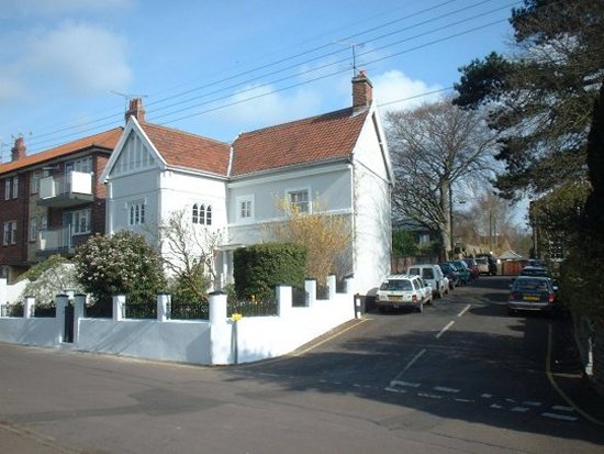
After William Lockwood completed ‘The Castle’ he built a Gothic house, which became known as ‘The Little Castle’, for his mother and father. The Little Castle is white building on the corner of Castle Street and St Johns Lane.

Lockwood went on to build other houses along the bottom of Castle Street. Their common feature was stuccoing – the use of cement to make it appear that they were made of stone.

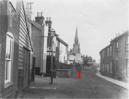
Lockwood was a member of a group of non-conformists known as the “Woodbridge Society for the Education of Poor Children”. In 1819 they founded a British and Foreign School in a large, white, bay fronted house, built and owned by Lockwood. The location of the house is indicated by the red arrow overlaid on the photograph on the right.

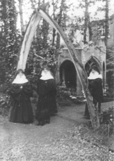
In 1923 the Sisters of Mercy founded the Convent of Our Lady of Lourdes, and the Convent School of St Philomena in Woodbridge. Both were located in a five bed-roomed house on a site behind The Little Castle.

There were only 24 Catholic children in Woodbridge when Convent School opened on the 15th September 1923 but by January 1924 there were 50 pupils. By October 1924 a bungalow had been built in the grounds to provide a dormitory for boarders, a classroom and a large dining room. The school also ran an evening class for adults. When the East Coast was designated a danger zone in 1940 the number of children in the convent dropped to seven and the number of nuns to two. The school closed for the Christmas holiday in 1941 and never reopened.

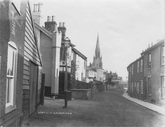
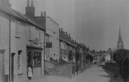
View down Castle Street in 1910.

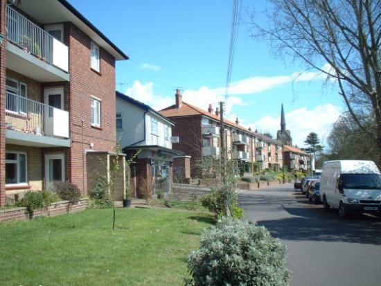
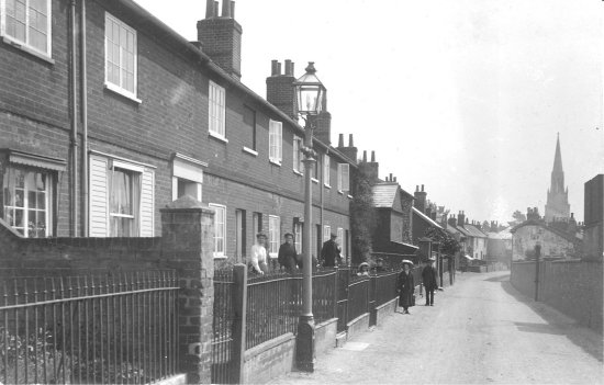
With the exception of the Little Castle, Compulsory Notices for Demolition were served, in the 1960’s, on all the on all the houses on the left of this photograph. They were soon replaced by blocks of three storey flats.

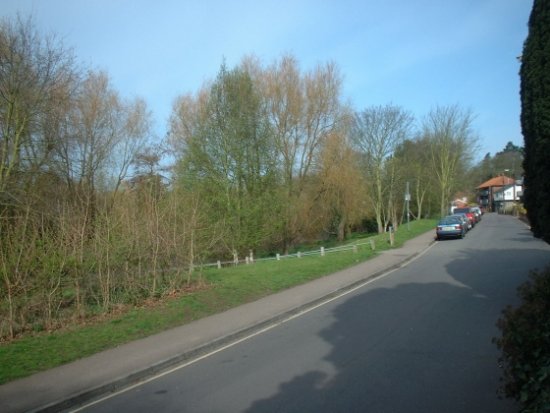
The long terrace of houses on the right of this photograph was also demolished in the 1960’s, The intention was to replace then with maisonettes, but subsequently it was discovered that the ground was not stable enough to allow the proposed development and the area became a green open space.

The blocks of three storey flats were either side of Mill Lane.

The green open space which was left after the long terrace of houses had been demolished has since been planted with this attractive mixture of trees.

Adjacent to the last block of three storey flats there is Stella House which is on the left of this photograph. It is listed as Grade II and is believed to be early nineteenth century.

Beyond Stella House there is this terrace of houses which is also Grade II listed are dated as being early nineteenth century.

The wall on the other side of Castle Street ran along the boundary of a market garden established sometime before 1892.

This photograph was taken from further up Castle Street.

The building on the left of the photograph eventually became the Bay Horse Public House.

This photograph shows the Bay Horse Public House after it closed. It, and the adjacent builders yard, were taken over by Seagers, a building merchant.

This photograph shows the former builders yard in 2012. At the rear of this yard there is a sandpit which had been excavated by William Lockwood’s workmen.

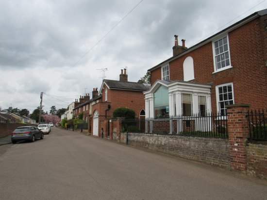
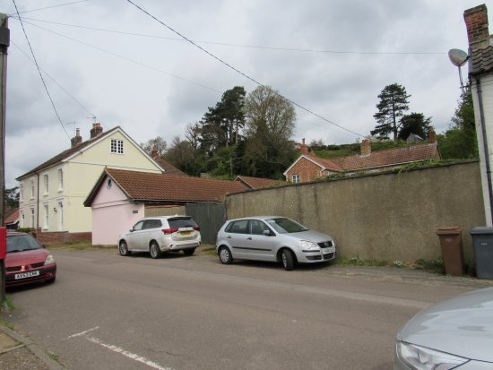
Behind the very dull wall in front or the former builders yard there is a house. Neither are noteworthy and they are in marked contrast with the adjacent pair of semidetached houses which are well proportioned and stand out.

On the land to the left of these houses William Lockwood built new premises for the British and Foreign School.

The school flourished until the non-conformist movement decided that their role in education could safely be left to the government. In 1909 it was replaced by the New Street County School.

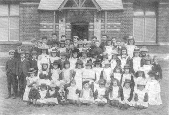
Either side of the entrance to the new school there was a terrace of four houses. After the pupils and teachers walked through the entranceway they climbed the steps which took then to platform on which the school and its playground had been built.
This photograph shows the school, its pupils and their playground.

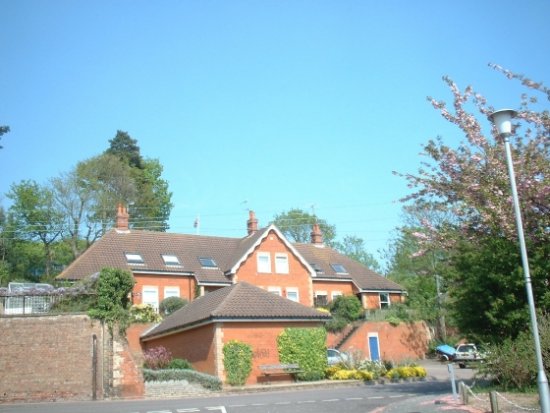
The old school was demolished by 1925 and 45 years later the houses in front of the site were also demolished. Two bungalows were built on the elevated site on which the school once stood. At road level, where the two terraces once stood, there were garages and parking space.

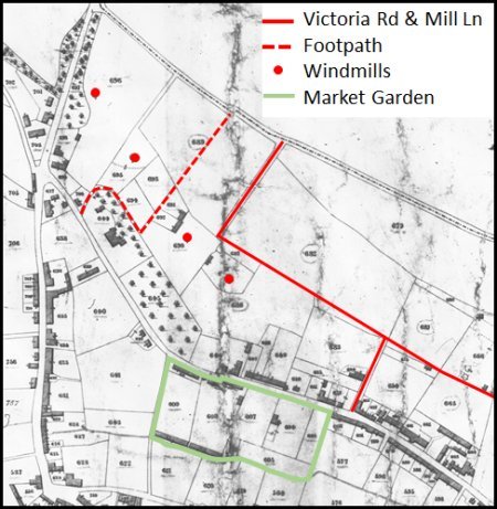
The red dots on the map to the left shows the locations of the four windmills which had been demolished by about 1886.

The red lines mark Victoria Road and the older Mill Lane.

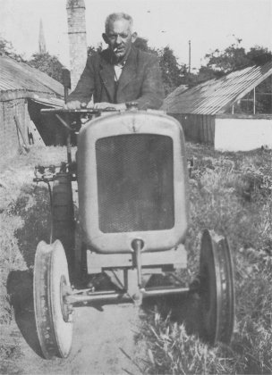
The green line is boundary of the market garden on part of Ship Meadow. The market garden had been had been established, some time before 1892, by Robert Steel and sons, fruit growers and market gardeners. Their specialties were tomatoes and cucumbers grown in two large greenhouses. The venture came to an end after the Second World War.

Robert Steel on his tractor.

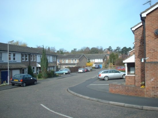
By 1975 an access road, named Naverne Meadows, had been laid across the which used to be Robert Steel and Sons’ market garden. The building of houses on the site was delayed by poor drainage but eventually the development was completed.

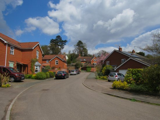
The development along Navern Meadows was soon followed by building houses on the upper part of Ship Meadow. The access road for this development was appropriately called Lockwood Close. This photograph shows the view looking along the entrance to Lockwood Close towards Castle Street.

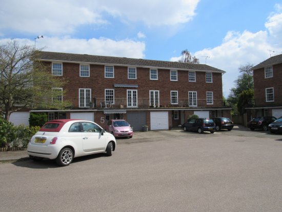
This photograph shows one of the three blocks of four apartments and garages at the bottom of Lockwood Close.

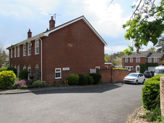
Adjacent to Lockwood Close there is this development of two semidetached houses. It was built on the site of semidetached house with large gardens.

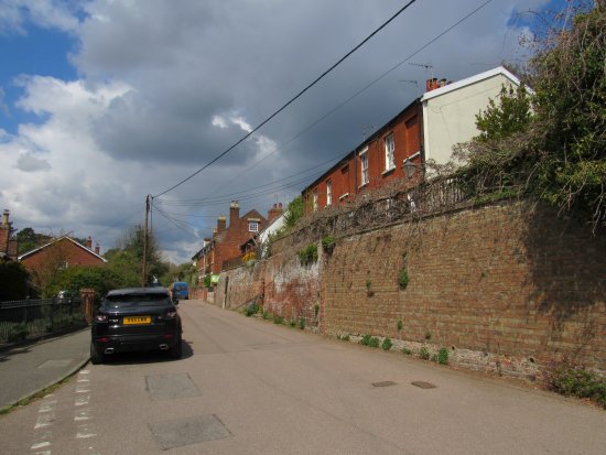
This elevated terrace of four houses is Grade II listed and it is believed to have been built in the early nineteenth century.

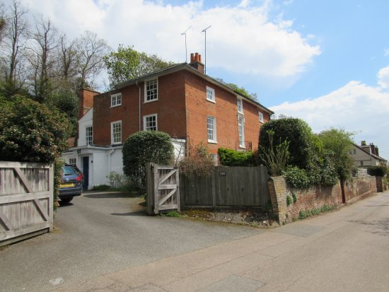
This impressive semidetached house is Grade II listed and is believed to have been built before 1800.

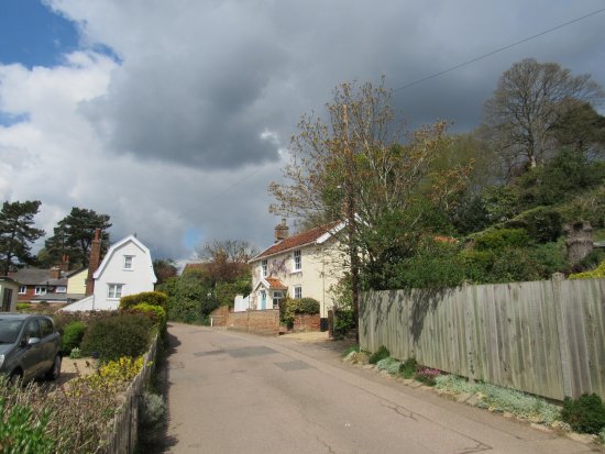
On the right of this photograph is there is a yellow house which Grade II listed. It was built some time before 1840.

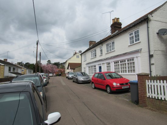
The white house with a mansard roof is also Grade II listed and was built some time before 1840.