Home > Street Histories > Bredfield Street, Chapel Street and Angel Lane
Bredfield Street, Chapel Street and Angel Lane
Bredfield Street, Chapel Street and Angel Lane in 1560
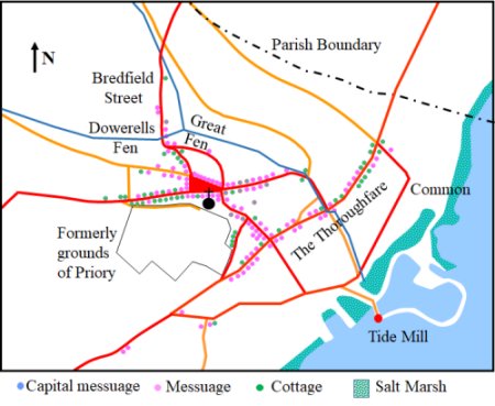
The earliest comprehensive description of the town is to be found in the 1560 Extent of the manor of Woodbridge late Priory. It is from this document, written in Latin, that the map on the right has been derived. The road layout is based on the 1881 OS map.
In 1560 Bredfield Street was called Baldrye Street and it continued up along what we now call Angel Lane.
Chapel Street was Fen Lane, presumably because it ran along the edge of the Great Fen – what we now call Ship Meadow. The Naverne Brook flowed through the Great Fen and Dowerell’s Fen.
The hill side at the top of Bredfield Street was named Le Conveyor – it was the Lord’s (rabbit) warren and the lower part of what is now the Woodbridge School grounds was called Dowerells Fen.
The coloured dots indicate the dwellings listed in the Extent. There were six on Bredfield Street, eight on Angel Lane and two on Chapel Street.
Changes Along Bredfield Street from 1560 to 1840
According to George Arnott Bredfield Street was being called Bredfeld strete by 1585. Chapel Street was Back Lane in 1692 and Cutting’s Lane in 1829.
The name Angel Lane first appears in 19th century directories. It presumably takes its name from the Angel Inn on the junction with Theatre Street.
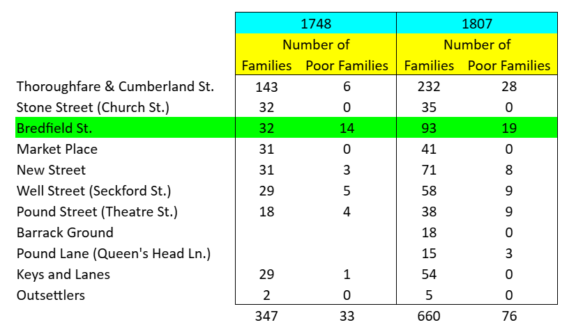
The Poor Rate returns are the first detailed record of the families living in various streets in Woodbridge. During the period 1748 to 1830 the number of families in the town increased by 284%.
Some of the Poor Rate returns also indicate which families were too poor to pay the rate and were thus likely to receive poor relief rather than contribute towards it. A summary of Poor Rate returns for 1748 and 1807 are given below. Based on the percentage of families that were too poor to pay the poor rate, Bredfield Street, Theatre Street and Seckford Street were the most deprived areas of the town throughout the period. Some 29% of the families living on these streets were in receipt of poor relief in 1748 and this dropped to 20% by 1807. Across the whole town the percentages were 9.5% in 1748 and 11.5% in 1807.
The Beaumont Baptist Church on Chapel Street was founded in 1787 by Jonathan Beaumont for the Countess of Huntingdon’s connexion. (The Trust Deeds of the chapel state that Dissenting worship can be carried out in the building but there is no mention of the denomination.)
In 1828 there was a pound, for stray animals in the middle of Pound Lane (Queen’s Head Lane) and Pound Street (Theatre Street). Some time later the pound was moved to the tip of the triangle formed by Haugh Lane and North Hill. The pound or ‘Pin fold’ is shown on the tithe map but is not numbered.
Number of families, and the number of families in receipt of poor relief, in 1748 and 1807.
Changes Along Bredfield Street After 1840
In 1861 the High Court of Chancery approved the amalgamation of the Charity of the Free Grammar School with the Seckford Charity. Up to this
time, the Free Grammar School had benefited from only a very small endowment, and was in cramped accommodation. Whereas the Seckford Charity, which ran the Almshouses and Hospital, had the advantage of sizeable reserves and an income well in excess of its needs. The Court’s decision changed eventually changed this imbalance.
The decision to divert money, originally intended for the aged poor, to support the Grammar School was made at a time when it was accepted that the middle and upper classes would have to pay for their children to be educated and there was concern about the number and quality of the schools available to them.
This led to a national debate about whether non-educational endowments having arcane or obsolescent purposes or which had become insignificant in comparison with the endowment, could be converted to educational purposes. The latter became the objective of the Endowed School Commissioners, who were empowered only seven years after the Court of Chancery’s ruling on the Seckford Charity.
There were several key features in the approved Scheme “For the Management and Regulation of the Charity of Seckford Hospital and Grammar School at Woodbridge”.
Up to £1,300 could be spent on repairing or rebuilding the old almshouses and the nurses’ house, provided this did not increase the number of places in the almshouses.
Additional help could be given to the town’s poor by spending up to £1500 on building a dispensary, £250 on a public pump and £50 a year on a lending library.
The remaining income of the charity could be spent on the Grammar School and a sum of up to f3,500 from the accumulated funds could be spent on a new building for the school. The number of children of the deserving poor offered free places at the school was increased from 10 to 20.
In 1880, the Charity Commission produced a new Scheme relating to “Woodbridge Seckford Hospital and Woodbridge Endowed Schools”. The part relating to the Seckford Hospital encompassed the Hospital, Almshouses, Dispensary and Library. The Scheme did not foresee any expansion of these facilities, and it stated that the residual income of the Charity could be spent on improving the school’s accommodation and efficiency.
Three acres of land were acquired, on the western side of Bredfield Street, for the new school and the building was completed by 1865. The new school was adjacent to a portion of land – Willard’s Meadow – owned by the Charity and this land was later incorporated into the school grounds. This meadow was a gift of Francis Willard in 1679.
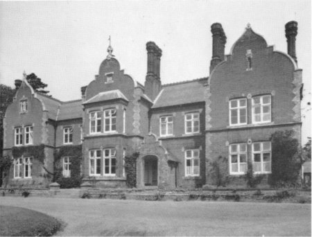
The Grammar School was erected on a three-acre site abutting the west side of Bredfield Street. The building, now called Marryott House, was completed by 1865. It included a residence for the Head Master and accommodation for 25 boarders.
Some 150 townsmen petitioned against the choice of location. They argued that the area was “mostly composed of tenements of the worst description. Boys having to pass through these localities would inevitably be brought into daily contact with those residing in the streets and lanes and be made familiar with scenes highly objectionable.” Moreover, the area, “a fertile source of malaria”, lay between the National and British schools. The grammar school boys would therefore be in danger of coming into contact with these pupils, “which would be most objectionable and ought to be avoided”.
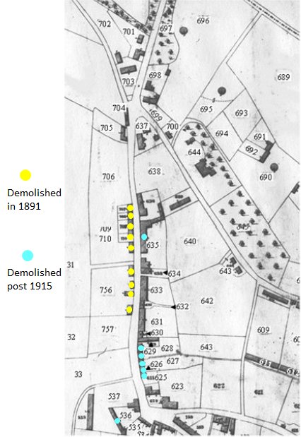
In 1895 New School House was erected and the grounds were enlarged to 34 acres. As part of the preparatory work, eight cottages on the western side of Bredfield Street were demolished in 1891 and the material sold by auction. The location of the demolished buildings are indicated by the yellow dots on the extract from the 1838 tithe map on the right.
New School House provided accommodation for 40 boarders, the assistant masters and the Head Master, whose previous accommodation in Marryott House was taken over by the Science Master. By the following year a block of seven classrooms and the school hall had been built. Extensive playing fields were also laid out.
Lamberts Almanac notes “an ugly farm-yard wall has been put up to enclose the property. We trust that the new building and other work will be carried out in a more elaborate and tasteful manner.” Most of the wall is now in front of a six foot high hedge.
Until 1908, the Seckford Hospital and the Woodbridge Endowed School were a single Charity, but in 1908 the Charity Commissioners split it into two charities. The Seckford Hospital received £2,000 a year from the Educational Charity and £891 from investments, and was under the jurisdiction of the Charity Commission. The Woodbridge Endowed School took the remaining part of the original endowment, and it was under the jurisdiction of The Board of Education. The governors were identical for each charity, and were thus able to transact all the business for both charities in one common meeting. This changed in 1920 when the school became a direct grant grammar school, and six members of the East Suffolk local authority were made Governors of the Endowed School.
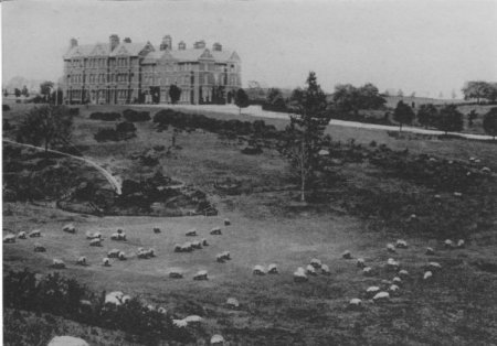
In marked contrast with the Seckford Hospital, Woodbridge Endowed School went through several stages of expansion after the charities were separated in 1908. The swimming baths were opened in 1925, the science laboratories in 1926 and the school chapel, built largely by the boys, was dedicated in 1927. Woodbridge Abbey and its 14 acres of land were bought in 1949, and the Junior School started there in 1950. This was followed by further building on the western side of Bredfield Street, where an art and technology block, sixth form centre, sports hall and music rooms were added between 1968 and 1974. Further additions followed including the addition of a Seckford Theatre for use by the school and the local community.
In 2016 Woodbridge School announced that it was going to make a planning applications which would have a significant impact on the Abbey School site and on the Queen’s House site on the western side of Bredfield Street. They wanted to co-locate the preparatory school, presently in Queen’s House, with the preparatory school at the Abbey School. This would involve considerable changes to the interior of the Abbey School, and there will be a new Activity Studio and music practice rooms. The parking area off Cumberland Street would also be increased.
To fund these, and other, changes, Woodbridge School wanted to obtain planning permission convert Queen’s House into flats and to build houses close to it and on the existing car park. The extent of the development is shaded light grey on the map to the right.
Planning permission was eventually granted for 32 homes on Queen’s Place and the development was completed during 2021. The area shaded grey of the map on the right shows the extent of Queens Place and some of the main access roads.
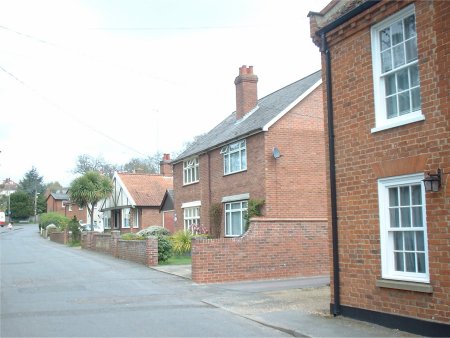
The map on the right also shows the four housing developments on Bredfield Street completed since the 1960’s. Each of these developments will be considered separately.
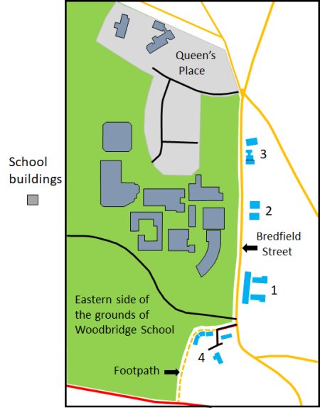
Development 1
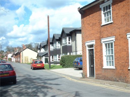
Development 2

Development 3
Development 4
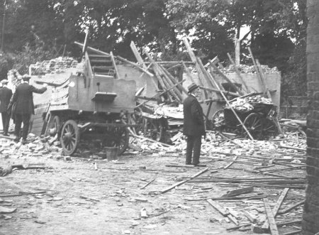
In the 12th August 1915 a single Zeppelin flew over Woodbridge and dropped a total of 28 high explosive and incendiary bombs. The outhouses of Wagon and Horses Inn was one of over a hundred buildings destroyed or damaged.
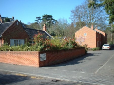
Sometime around 1985 the Wagon and Horses Inn was restructured to create two houses. Five other houses were built on what used to be the rear yard of the Inn. Access to these five buildings and their garages was via Waggoner’s Court. A more suitable name would have been St Peter’s Square. This is what the area formed by the junction of the three roads was called until the early 1800s.
Changes Along Angel Lane and Chapel Street After 1840
Pre 1840 buildings which were demolished and either rebuilt or incorporated into adjacent plots
The Liberty of St Etheldreda was first recorded in a document relating to the rededication of Ely Abbey in 970. This abbey was the result of an endowment at Ely by Etheldreda, the daughter of King Anna, who ruled East Anglia from 636-654. It is believed that the Liberty of St Etheldreda was even older than the earliest reference to it, and that it was part of the original endowment of a convent founded at Ely by Etheldreda in 673. This convent eventually became part of Ely Abbey.
The Liberty of St Etheldreda encompassed the former Royal Hall at Rendlesham and the royal pagan ship burials at Sutton Hoo and Snape. It was thus the heartland of the pagan Kingdom of East Anglia. Some historians suggest that the decision to grant away this area to a monastery may have been an action to distance the, then Christian, royal family from its pagan past. The first Christian Kings of East Anglia, Sigeberht and Anna, were both buried outside the area which became the Liberty as was the Royal Hall which Anna moved from Rendlesham to Blythburgh.
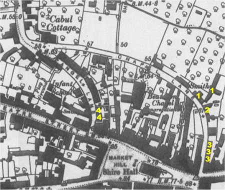
This extract for the 1880 OS map shows Angel Lane and Chapel. The yellow numbers mark the buildings which were demolished post 1880.
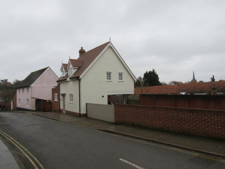
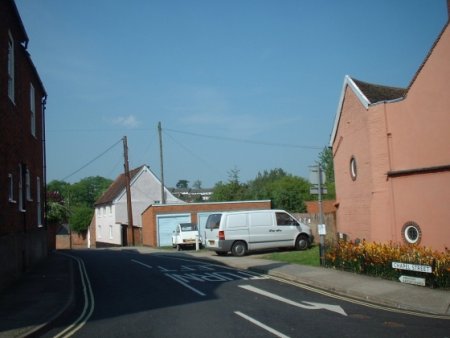
This photograph shows the extended grounds of the white house at the entrance to Chapel Street. The five bar gate in the entrance to the garden and garage.

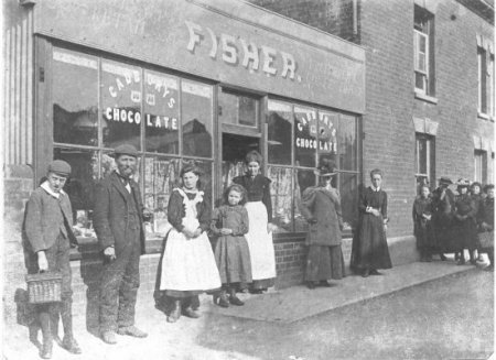
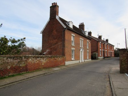
Further along Chapel Street there was another cottage which had been enlarged into a very attractive building named The Garden House.
Beyond The Garden House, the southern side of Chapel Street ran alongside Ship Meadow before reaching Cabul Cottage at the entrance to Chapel Street. The photograph below shows Ship Meadow in about 1935. The meadow was not used for housing until the 1980s
In about 1850 the builder William Lockwood recalled that “The clear water running through the meadow was used for washing wool which was then dried by spreading it out on the grass or by hanging it from lines and poles. Combing and carding of the wool was carried out in one storey huts running across the meadow. Some of the wool was spun into yarn in these huts, the remainder was processed in the cottages where the combers and carders lived.” In the 1840 Tithe apportionment the area is called Ship Meadow. The word ship also appears in the field names listed in the Tithe Apportionments of other Suffolk parishes – often in areas well away from navigable rivers. In such cases ship is taken to be a corruption of sheep. There are, however, some who still believe that the name Ship Meadow indicates that the Naverne Brook was navigable up to Bredfield Street.
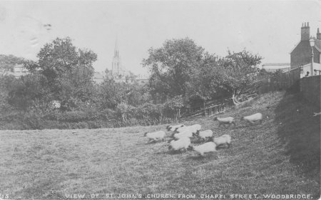

In 1930 three local businessmen set up a jam factory at the top of Angel Lane to create employment in the town for women. The factory is believed to have been in the building at the junction of Angel Lane and Market Hill. It probably closed when the businessmen set up a canning factory on Hamblin gardens.
The closely packed houses on Angel Lane remained unchanged until the early 1950 when two houses at the top of the eastern side of the lane were demolished to make way for an outlet of Ken Blaxill, builders merchants and glass suppliers.
The two houses are each numbered 4 on the extract from the 1880 OS map. There had been a blacksmith smithy on this site in 1840.
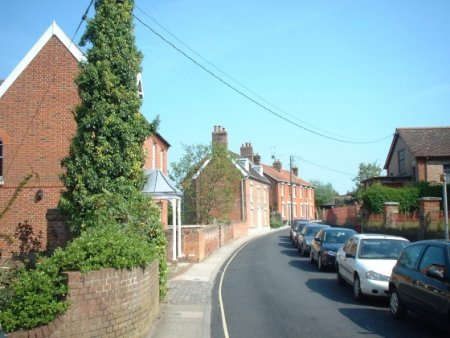
In 1983 the Ken Blaxill moved their business to a new industrial estate in Melton. Soon after the Angel Lane site was cleared and two houses in the centre of the photograph on the right were built. They both fit in well with the surrounding older buildings.
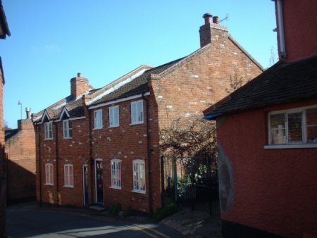
Post 1840 houses built on sites which had not previously been developed
The map shows the location of all the buildings on Chapel Street and Angel lane by the end of 2020. The buildings shaded blue were built on land which had not previously been developed.
All but one of the buildings shaded grey were houses which date back to before 1840. The one exception being the terrace of four houses which was built on the site of a blacksmith’s smithy some time between 1880 and 1904.
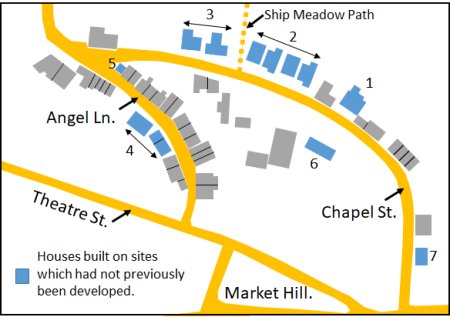
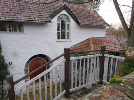
The house numbered 1 on the 2020 map was built sometime after 1927. It is set back from the road and its ground floor is about 10ft below the level of the road. Access to the front door is via steps and vehicular access to the rear of the property is by shared access to the drive of the adjoining house.
The group four houses numbered 2 on the 2020 map were erected in the early 1980s. Each of these houses had a gable end which was at right angles to the road. One of these houses was set back and thus its gable end cannot be seen on the photograph on the right.
At the end of this line of houses there was Ship Meadow Path which gave pedestrian access to Castle Street.
The photograph on the right also shows the pair of houses built between 2003 and 2010. These houses, which were between Ship Meadow Walk and the grounds of Burkitt House, are numbered 3 on the 2020 map.
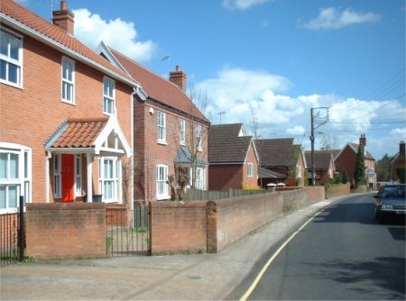
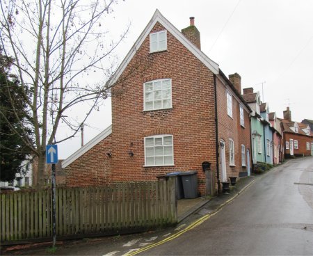
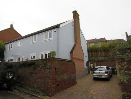
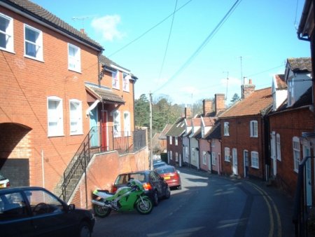
The southern side of Chapel Street has changed little since 1804. Apart from the Beaumont Chapel, and a line of houses adjacent to it, all the gardens, driveways and garages on Chapel St. are on the back entrances of houses on Market Hill.
The worship in the Beaumont Chapel was congregational and there were close links with the Quay Congregational Church until 1904. At that time the Beaumont Chapel and was influenced by the strict Baptist Chapel in Grundisburgh. In 2006 the links with the Quay Congregational Church were re-established and it was decided to close the Beaumont Chapel and to apply for planning permission to turn it into a house.
When the conversion was completed the adjacent, single storey Church Hall, was demolished and was replaced by a house.
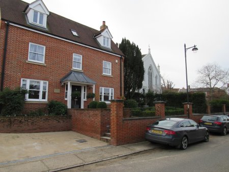
In about 2019, The Old Court House, an Abbeyfield retirement home on Market Hill, was sold to a property developer who split the building into a number of apartments. He also demolished the garages and a parking area, which had previously been reserved for The Old Court House, and replaced it by small house with an enclosed parking area.