Home > Street and River Photography > New Street
New Street & OAK LANE
New Street
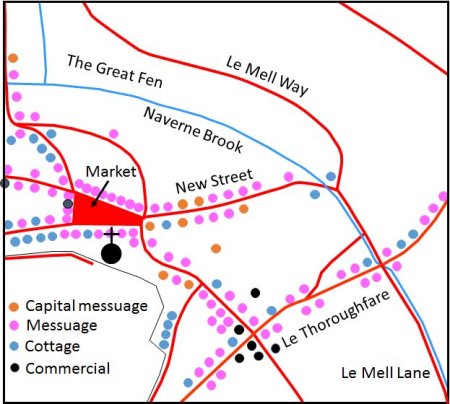
Le New Strete was first mentioned in 1549. It had been laid out to provide an alternative route from the Market to the river. A map of the area in 1560 is shown on the right. It is based on the description of the town given in an Extent of the manor of Woodbridge late Priory. Le New Strete joined Le Mell Waye (now Castle Street and St John’s Hill) which was also referred to as the way to the lord’s mill (the Tide Mill). It ran down to Le Thoroughfare. From there the route to the Tide Mill and the quays was via Le Mell Lane (now Brook Lane). The dots on the map indicate the dwellings and commercial buildings listed in the Extent. The dwellings on New Street were all above the entrance to what is now Castle Street.
The 1840 tithe apportionment lists 39 buildings with frontages on the street whereas in 1560 there were only 17. Thirteen of the buildings listed in 1840 were described as cottages. Based on what is left on the site of these cottages today, they would have provided a total of 32 individual dwelling. When this is taken into account the number of dwellings on New Street 1840 rises to 58. A number which is significantly lower than the number of families recorded in the 1830 rate returns. There must have been, therefore, many cases where several families shared the same dwelling.
White’s 1844 trade directory is the earliest detailed record of the commercial activities on New Street. There were 18 shops, 3 merchants, 16 artisans, 4 public houses, 3 people offering personal services (hairdressers) and a bank. Only the Thoroughfare had more commercial activity than New Street.
During the period 1844 to 1985, The Thoroughfare was the only street not to experience a decrease in the number of shops and other commercial outlets along it. New Street went from being the second most commercial street to the fourth in 1985. Since then commercial activity on New Street has continued to decline.
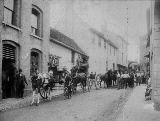
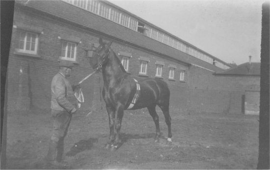
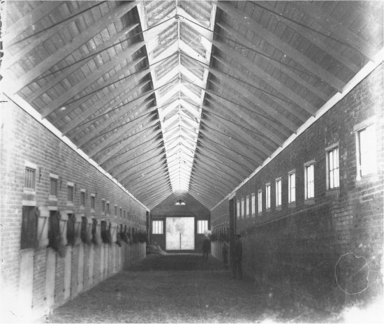
John Grout became a horse dealer of world renown. By about 1880 he had purchased two houses and an extensive garden opposite the rear yard of the hotel. He had the site cleared and then used it for a large complex of stables, called the Bull Ride. It was capable of housing up to 170 horses and representatives of both the Kaiser and the Viceroy of India came there to buy horses for the imperial and vice-regal stables. After John Grout died in November 1886 his horse dealing business, and the Bull Hotel, were taken over by William Miles. Ten years later the King of Italy granted William Miles the right to display the Royal Coat of Arms and for many years it proudly adorned the front of the Bull Hotel. After Miles died in 1899 the horse dealing business faded away.
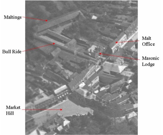
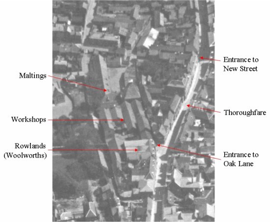
This aerial photograph taken circa 1935 shows the extent of the Bull Ride and the surrounding area.
The Maltings and the Malt Office were demolished by 1925. Part of the site was eventually cleared to make way for a Co-Operative milk depot which was later replaced by a Co-Operative funeral parlour.
This photograph show part of the extensive exercise yards associated with the Bull Ride.
The Bull Ride has been used for a variety of purposes.
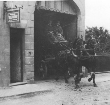
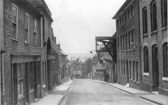
A telephone exchange was installed in the front part of the Bull Ride in 1902. The service was provided by the United Telephone Service which was taken over by the Post Office in 1912.
After the the First World War the demand for horses decline rapidly the Bull Ride began to be used for other purposes. For a while is was used for workshops and then as a picture gallery, a wholesale outlet for arts books and eventually for the sale of antique and second-hand furniture. In 2016 planning permission was granted to convert the Bull Ride into a restaurant.
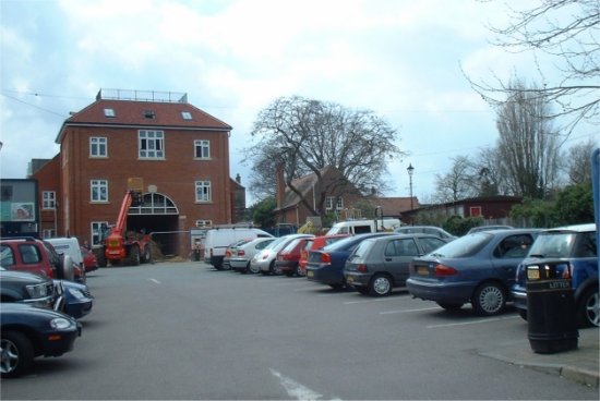
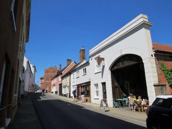
Today all traces of horses in the Bull Ride have gone and the arched entrance to yard of Bull Hotel has been replaced by a wider, rectangular passageway to a car park.
On the other side of the street part of the Bull Ride has been demolished but the main spine of the building has been left intact. The part nearest to New Street has been retained as a large open space. It is called New Street Market and it currently deals in food, fashion, flowers and home wares.
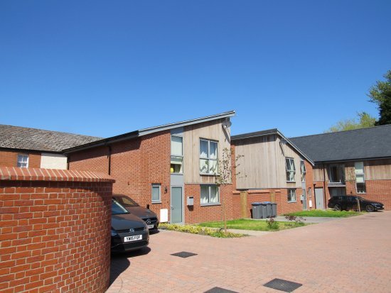
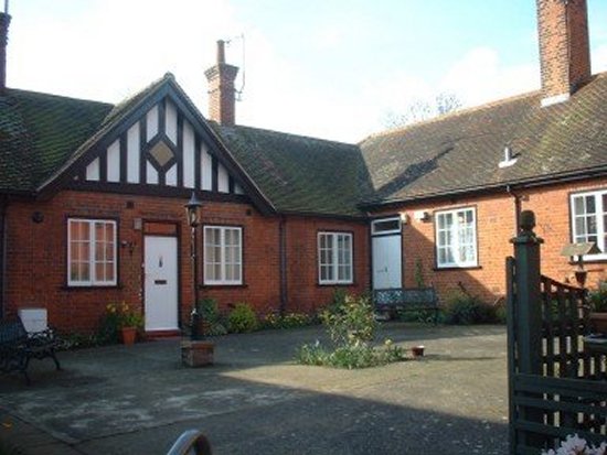
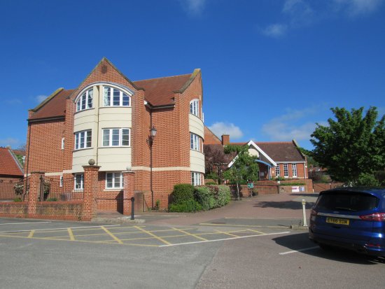
The remaining section of the spine of the Bull Ride has been integrated into an attractive housing development.
By 1906 a Masonic Lodge had been erected beside the Bull Ride. The Lodge was set back from the road and only half of the building can be seen in this photograph.
Most of a malting complex next to these Lodge had been demolished by 1925. The remaining part, which abutted New Street, was eventually cleared to make way for a Co-Operative milk depot which was later replaced by the Co-Operative funeral parlour. The 1987 Town Centre Plan noted that the funeral parlour “occupies a prominent position but makes no contribution to the quality of the street. Other buildings on the site, although occupied, appear to be in a poor physical condition. It seems reasonable to expect some changes in this area in the next few years”.
It was not until 2016 that planning permission to implement such changes was sought and granted. When the new buildings were erected the view across the valley to St John’s Church was lost.
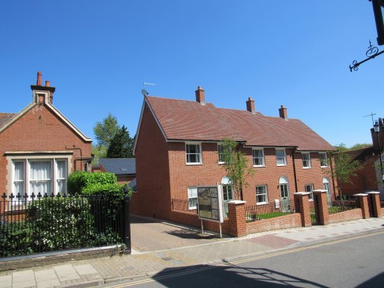
A terrace of three, two storey houses has been build on most of the land which had been used for the Co-Operative funeral parlour.
On either side of the terrace of 3 houses there is lane leading to Bull Ride Mews.
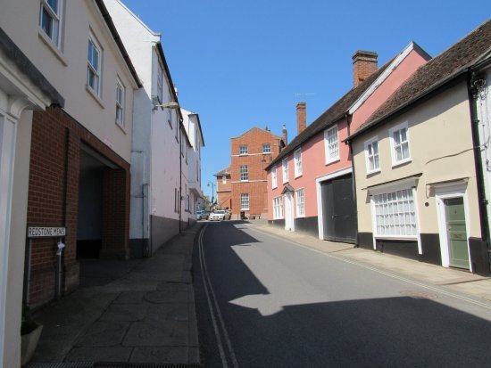
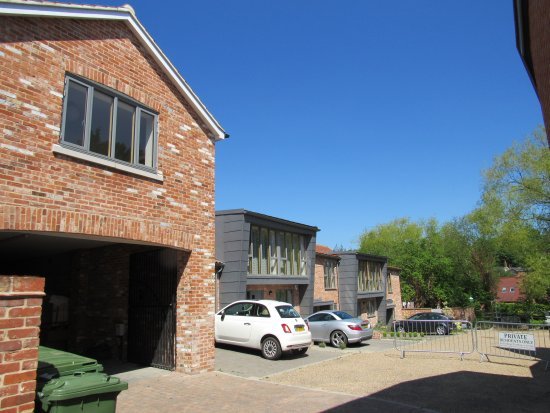
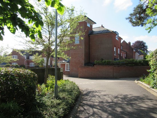
This photograph shows the lane between the terrace of three houses and the The Masonic Lodge. This lane leads to the right hand side of Bull Ride Mews where there are three houses. Each of these houses incorporates a section of what used to be The Bull Ride.
The building on the left of this photograph is a large garage associated with end section of the New Street Market. Work on completing this part of the project is currently underway.
Beyond the garage there line of three houses. Each of these houses includes a section of the former Bull Ride.
On the right hand side of terrace of three houses set back from New New Street there is an other lane leading a new development of three houses.
This photograph shows the new housing in greater detail.
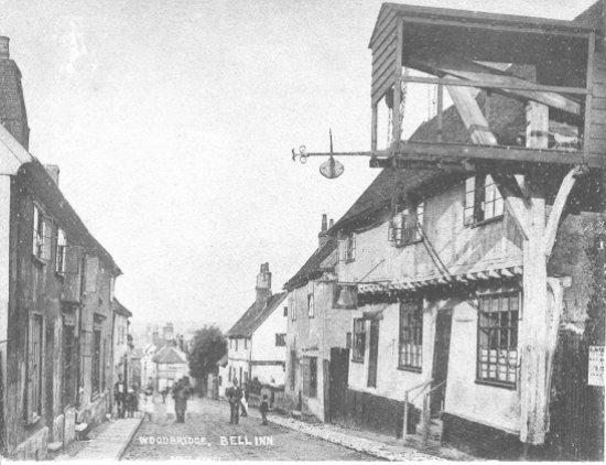
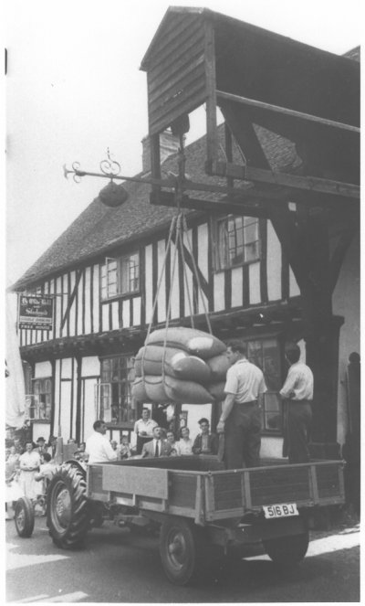
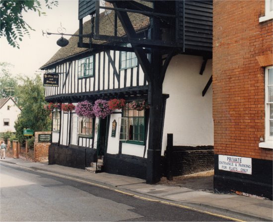
In 1840 there were four public houses on New Street. The oldest of them was The Fox Inn which is first mentioned in 1617. It is now The Bell and Steelyard.
It is not known when the steelyard was erected but it had a long history of being used to weigh loaded wagons on their way from the market to the quays by the river.
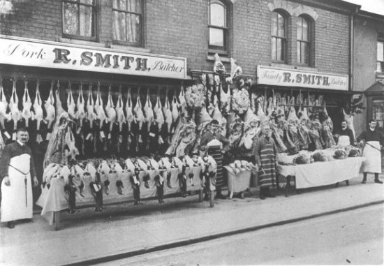
The Bell and Steelyard is on the right of this photograph. On the left of the The Bell and Steelyard there is a butchers shop and a line of four cottages set back from the road.
Sometime between 1904 and 1926 the butchers shop and the line of four cottages had been demolished and was replaced by an imposing pair of semidetached houses set back from the road.
This photo shows a 1960’s demonstration of how the steelyard was operated.
One of the key features of Bell and Steelyard is its hanging baskets.
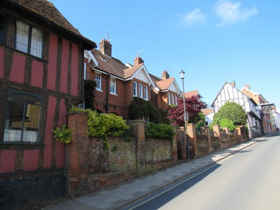
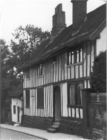
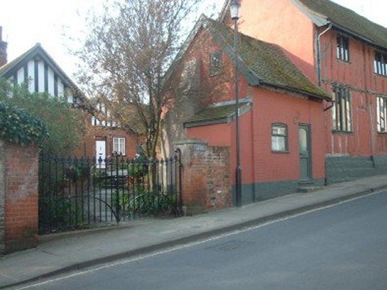
Most of the buildings lining New Street in 1560 would have been timber framed. The building with the earliest recorded history is now called the Bridewell and a 1950s photograph of it is shown on the right.
In 1587 the building was called a House of Correction. By 1641 it was also being used as a Hospital or Workhouse for the deserving poor of the town. After the battle of Sole Bay in 1670 the great number of Dutch prisoners who had to be accommodated in the building forced the townspeople to establish a new workhouse on Theatre Street. The New Street building remained as a House of Correction until 1804 when it was converted into a Hospital where the frail poor could live in rent free apartments.
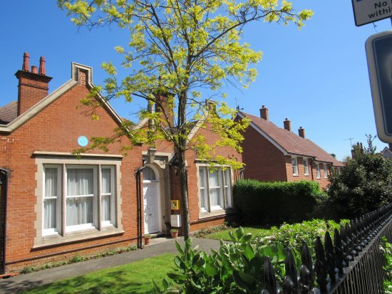
In 1908 seven almshouses were built in the yard of The Hospital. These almshouses were a bequest from John & William Andrews in memory of their father Jonathon Andrews of London “A former resident, well-known for his good works in his old town.” Each almshouse comprised a bed sitting room, a scullery and an external earth closet. They were let to the deserving poor for sixpence a week.
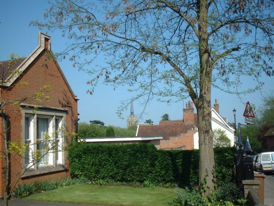
The Town Council eventually sold The Hospital and it became a private residence.
Since 1960 the Almshouses have been managed by the Poor’s Houses Charity. This Charity was endowed with various buildings and properties which had been given to the town to help care for the poor. The proceeds from the sale of these assets were used to modernise the almshouse. They now consist of two units having a single bedroom and a unit, with two bedrooms, which is fully wheelchair accessible. One of the original external earth closets has been conserved for historical interest.
New Street and Oak Lane
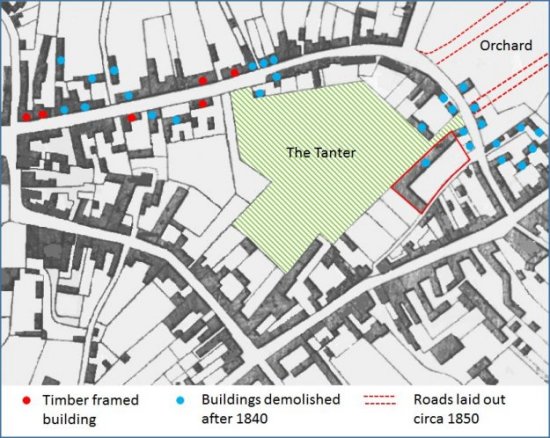
A simplified version of the 1840 tithe map is shown below. The blue dots mark buildings which were demolished post 1840. The red dots mark the 6 buildings which were found to be wholly or partially timber framed when a survey was conducted in 2004. The green crosshatched area was the garden of Alexander’s bank (now Barclays) on Church Street. Most of the garden was called The Tanter.
The building outlined in red, which abutted The Tanter, the garden was a maltings. This three storey brick building was sold by John Cobbold in 1876.
In the 1950s and 60s the building was used as plumber’s store and a coach builder’s workshop. It was then taken over by the builder Ingram Smith who moved out in 1971 and sold the property to the Urban District Council. The Council demolished the maltings and used the site for the Oak Lane car park which opened in 1975. Some cottages just above the entrance to the new car park were removed and replaced by two dwellings with another four behind in Oak Court.
The Country School was built in 1909, on what had been The Tanter, to replace the British and Foreign School on Castle Street.
The school was within the arrow shaped area which is on the left of the aerial photograph taken circa 1935. There were two entrance to the school grounds. Between the entrances there was terrace of buildings abutting New Street.
This photograph shows a sweet shop which was a mecca for the children attending the Primary School. The shop abutted the eastern entrance to the school.
The 1971 Town Plan envisaged a Market Hill bypass running down the Naverne valley to a car park on the site of the Country Primary School, which was to be moved to Melton. The threat of these changes, and a proposal to widen New Street, blighted the line of 18th century cottages adjacent to northern edge of The Tanter and many fell into a semi-derelict condition. When the road widening proposal was dropped in 1975 the District Council decided to restore the cottages. The only building to be demolished was a house, which at one time been a sweet shop, at end of the terrace. The vacated site was used for a private parking area and a small courtyard.
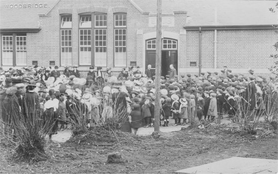
This photograph shows the opening ceremony of the Woodbridge County School.
In 2001 Suffolk County Council and Greystoke and Everleigh Ltd. unveiled a scheme to relocate Woodbridge Primary School and Woodbridge Library. The school would be moved a site at the bottom of Pytches Road and a new library would be created in part of the old school. The new school and library would be funded by the developers who, in return, would have the remaining land on which to build 23 houses and a medical/health facilities for the surgery in Little St John’s Street.
Opposition to the proposal came from Woodbridge residents who were mainly concern about (i) the loss trade because parents would no longer use the local shops when delivering or collecting their children and (ii) the visual impact of the new residential build on the surrounding area. Opposition from Melton residents were, in the main, based on the belief that the sale of some of the designated plot for residential development had reduced the viability of the site for a school and on concerns about (i) the impact of traffic delivering and collecting children from school and (ii) the lack of adequate footpaths along Pytches Road. Supporters accepted that (i) it was not economically viable to bring the old school up to modern standards, that (ii) the majority of pupils attending the school were from Bury Hill area, and (iii) that pedestrian access from that area to the old school was inadequate. After several public consultations a formal planning application was submitted in January 2004 and was approved in July of that year.
This aerial photograph taken circa 1935 shows the extensive building between Oak Lane and the grounds of the Woodbridge County School. To the north of Rowland’s Department Store (later F W Woolworth) there was a extensive range of workshops associated with the store. Most of the latter were demolished in in the 1940s to create Oak Lane Car Park. Access to the car park was via the Thoroughfare. Ownership of the land was land was retained by F W Woolworth and this was later to effect the future development of the car park.
By 1989 all the buildings associated with the maltings had been demolished and the Oak Lane Car Park had been expanded significantly. The was access to the car park from both New Street and the Thoroughfare.
In 2005 F W Woolworth exercised their right to build on that part of the Oak Lane Car Park which belonged to them. Soon after they were granted planning permission to erect a three-story building with basement car park, to provide three retail units and 14 one-bed residential units.
New Street
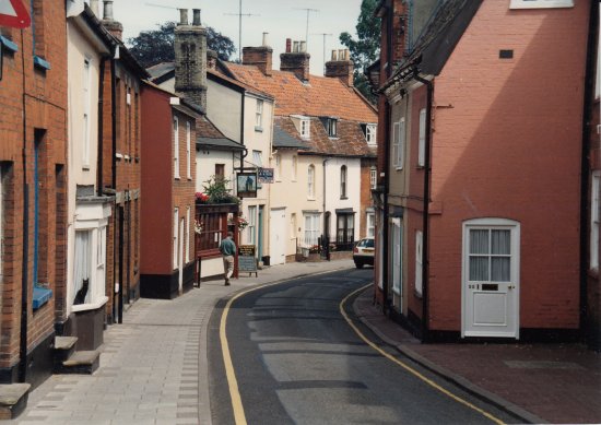
This series of photographs show the buildings on the eastern side of New Street.
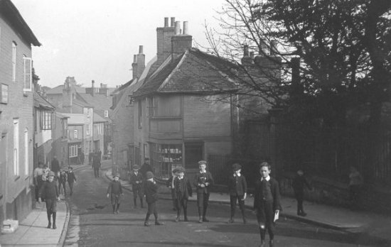
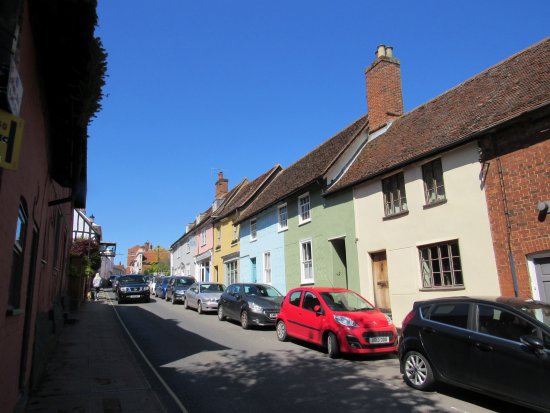
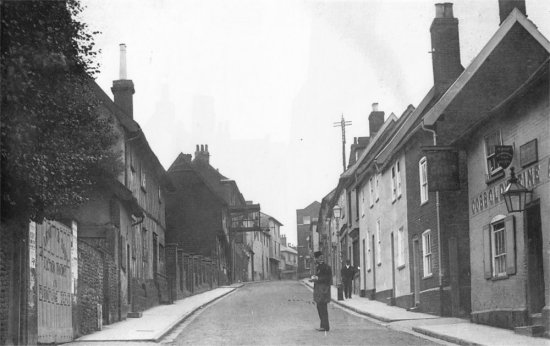
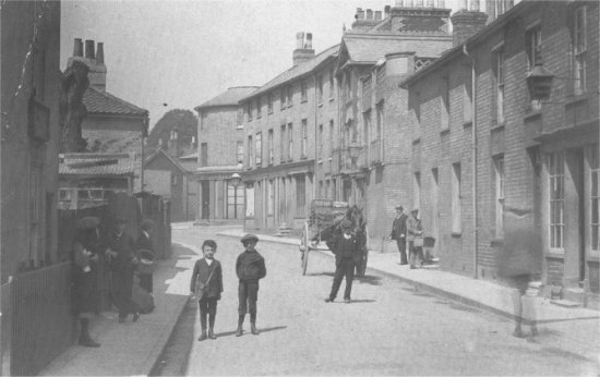
This photograph of the top part of New Street was taken in about 1900. Little has changed since then.
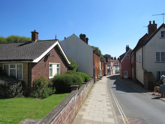
A workshop and cottage, nearly opposite the entrance to the school, were demolished in the 1930s to provide access to an orchard at the rear. Before the Second World War one of the buildings left standing on the site was used for a Lads’ Club. By the 1960s the whole space was occupied by a line of bungalows perpendicular to the road.
New Street and Oak Lane
During the 1840s developments started which significantly changed the lower part of New Street. The first step was the building of St John’s Church which was consecrated in 1846. The entrance to Castle Street became known as St John’s Hill and a number of roads were laid out around the church to enable future developments. These roads included St John’s Street and Little St John’s Street.
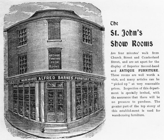
The most notable of the new buildings had a round front. It was between the entrances to St John’s Hill and St John’s Street. Until 1904 it was Alfred Barnes’ showroom for ‘superior second-hand and antique furniture’. It later became an estate agency.
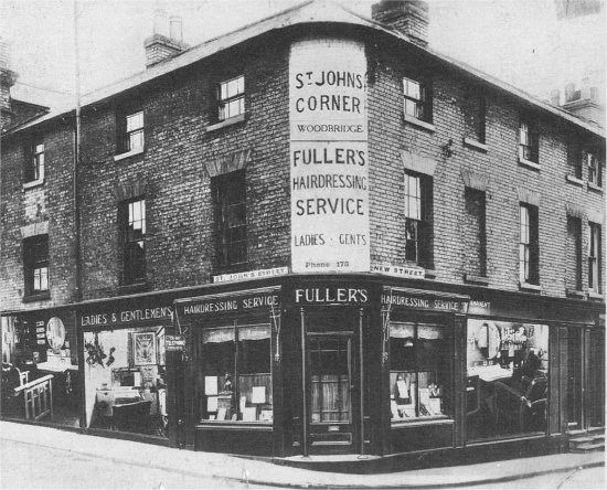
This imposing building was on the right of the entrance to St John’s Street.
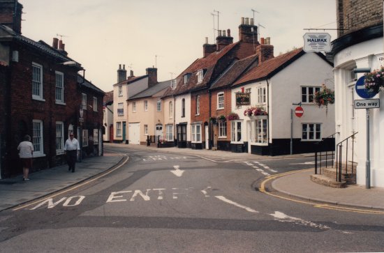
By the 1940s the land behind the fence of the left of this photograph had become part of Oak Lane Car Park. There was access to the car park from both New Street and the Thoroughfare.
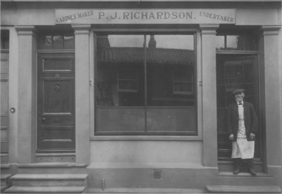
On the other side of the road there was the cabinet making and undertaking business run by P J Richardson,
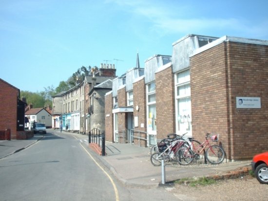
Below Little St Johns Street there were cottages and other buildings built before 1838. Most of this site was used in 1975 to build a public library. During this work it was found that the drain installed in the 1860s to carry the Naverne brook under the road was near to collapse. The drain had been formed by digging a deep channel, covering it by logs, and then putting the road surface on top. During the 1975 redevelopments it was found the road was near to collapse because the logs had rotted.
There is speculation that one of the building demolished to make way for the library was the Jubilee Hall. It was built between 1881 and 1904 and it was on the other side of a passageway which is alongside the Salvation Army Hall.