Home > Street and River Photography > Quay Street
Quay Street
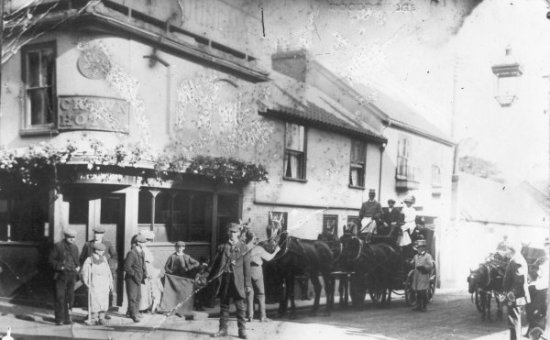
The Crown Hotel was one of the main coaching inns in Woodbridge.
This picture of the Crown Hotel was taken towards the end of coaching era. The man in the centre of the photograph was Poll Reynolds, a self appointed traffic warden. He died in 1910 aged 32 and is buried in the old Woodbridge Cemetery.
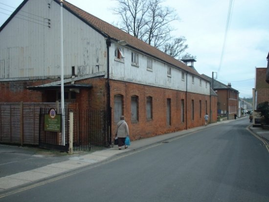
This building, which used to a maltings.. The walls on the ground floor were brick and they supported a timber upper storey. The southern end of the building has the characteristics of a heating stack used in maltings. The windows on the ground floor are a later addition and indicate a change of use.
Some time before 1937 the maltings was converted into an annex, called the Assembly Rooms, of the Crown Hotel. An entry in a Trade Directory for that year states that adjoining the Crown Hotel there was “a large assembly hall accommodating 300, with a dance floor; the hall is also used for meetings, shows, etc.” The Assembly Rooms have been derelict since the 1970s but they are still part of the hotel complex.
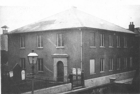
The Quay Congregational Church was formed in July 1651 by the Rev Woodhall, together with fifty-five “brethren and sisters”. In 1689, John Bass, purchased the piece of ground on which the present Quay (Street) Congregational Church stands. The first Church to be erected on the site could seat 500. The present Quay Street Congregational Church was erected in 1805 on the site of the old one.
Between 1840 and 81 an narrow extension had been added to the southern end of Quay Street Congregational Church. The extension was a porch which provide direct access to the church from Quay Street.
In 1896 the Quay Street Congregational Church was renovated, new seats were installed along with a new pulpit, new system of ventilation and gas lighting. The organ was also overhauled and cleaned.
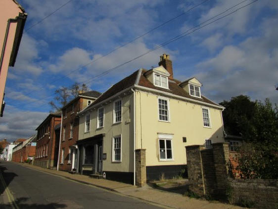
By 1827 a three storey house and a elegant two storey house had also been been erected just below the Congregational Church.
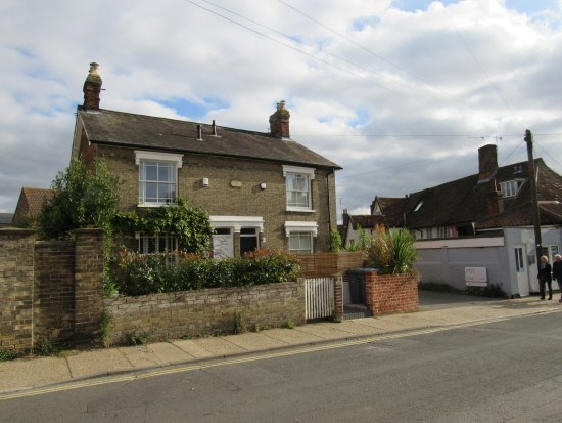
Below the two storey house there was a large garden. By 1875 the lower part of the garden used to create two semidetached houses which were set back from Quay Street.
Below the semidetached houses there was a triangular plot of land on which there was a building which was later used as an office.
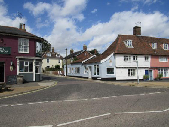
Below the triangular plot of land there a single storey extension, with a sloping roof, which runs down to abuts Quay Street and Quayside. In 1840 this building was Studd’s Quay Counting House.
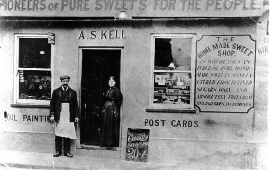
For some time what used to Studd’s Quay Counting House became The Home Made Sweet Shop run by A.S.Kell.
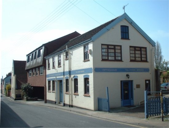
This modern photograph shows that there have been several extensions to what used to be Studd’s Quay Counting House. There are all coloured light blue.
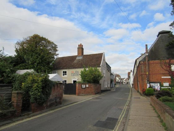
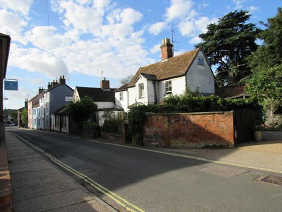
These two modern photographs are included to show the four houses below Quay Street Congregational Church in greater detail.
The earliest detailed map of Woodbridge was produced by Isaac Johnson in 1827. This map clearly shows that development along the western side of Quay Lane had been constrained by a mansion and gardens which ran all the way from Cumberland Street to what is now Station Road and that, on the eastern side of the lane, a significant part of the Crown premises was laid out with gardens.
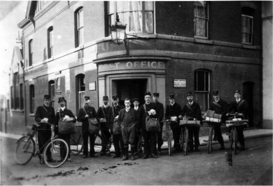
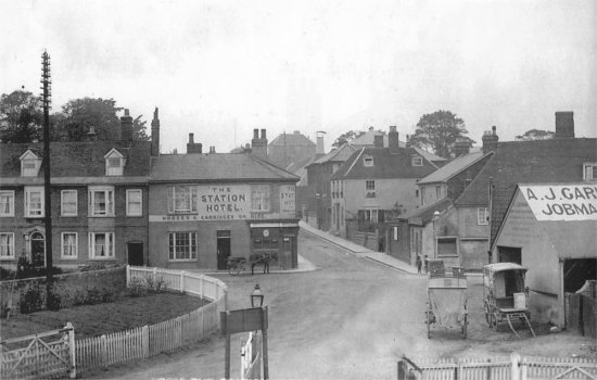
n 1874 the Woodbridge Post Office was established in this building on the corner Quay Street and Cumberland Street. By 1925 the adjoining property was being used A.J.Garnham, Jobmaster and Funeral Carriage Proprietor. The entrances to both buildings were on Cumberland Street.
By 1934 the Post Office required more space so it was moved to a new building further up Cumberland Street. A.J.Garnham continued to use the adjoining building. For some time the ground floor of the former Post Office was used as a hat shop. Both the former Post Office, and what remained of A.J.Garnham’s property, were demolished in the 1960’s.
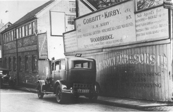
A comparison of the 1840 Tithe Map and the 1881 Ordinance Survey maps shows that the layout of the buildings on Quay Street, which were below the Post Office, had changed significantly. The part of the Post Office which ran along side Quay Street had been reduced in length in order to create a yard for R H Rowland and Sons Ltd. Their main outlet was on the Throughfare.
By 1881 two new buildings had been erected between R H Rowland’s yard and the house which is now called the Captain’s Table. Both of the new buildings ran alongside Quay Street and they had yards at the rear. There is no photograph showing all three buildings.
The photograph on the right shows the yard below the Post Office and the first of the three buildings and the gable end of the second.
The line of three closely space buildings remained intact until 1983. At that time the building in the centre was demolished and it was replaced by Sutton House, a three storey red brick building. There were two apartments and each had half of the second and third floor. Each apartment had a parking space on the ground floor.
Since 1840 the building which is now called The Table has change little and it still retains the large courtyard and garden.
Number 5 Quay Street, what used to be the Customs House, is in the centre of the picture on the right. It is set back from the road and has the potential to be an more imposing building. On the 31st March 1882 Woodbridge ceased to be a port for the purposes of the Customs Consolidated Act 1876. Thereafter, Woodbridge came under the jurisdiction of Ipswich and her Registry was withdrawn and the former Customs House became a private residence.
Number 7 Quay Street, abuts the southern side of the former Customs House. Most of the building is post 1840 but the part of it which abuts the former Customs House is timber framed. Thus it is possible that Number 7 incorporates some part of the Old Customs house. This is the only shop which has been continuously recorded on Quay Street since 1840.
Between number 7 and the Anchor Inn there is an attractive terrace of two and three-storey buildings. They appear to be the same as they were in 1840.
Below terrace is the Anchor Inn which has entrances on Quay Street and Quayside.